CR55
| CCC Camp Road |
Power Line Cuts |
Old Flagg NW Trailhead |
Clearings Around Cabins |
Pinhoti Trail Northbound |
Weogufka Creek |
|---|
|
Tower / Pinhoti Parking |
|---|

| Flagg Mountain Trail System |
Old Pinhoti Terminus |
Weogufka Creek |
|---|
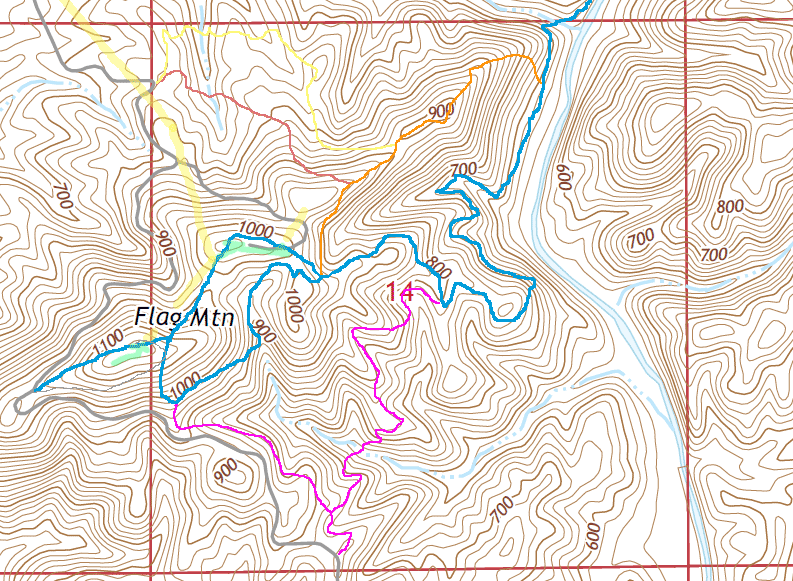
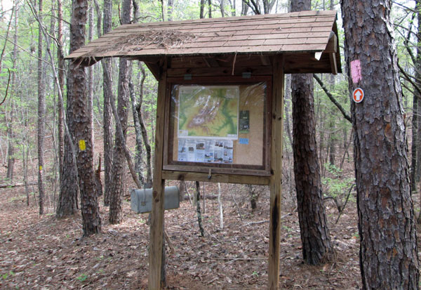
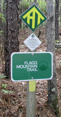
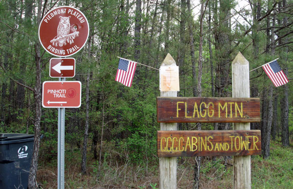
This page discusses facilities located at the Flagg Mountain Trail System Trailhead located north of the Flagg Mountain Tower and Cabins. On the map below, it is in the upper left corner at the intersection of the grey CCC road and the trails shown in red and yellow. It is near a power line cut and at a sharp curve in the road as it ascends Flagg Mountain. A photo of the kiosk and mailbox, and another of signs, are at this location. I believe a picture of a birding sign and Flagg Mountain sign are further northwest, at the intersection of dirt CC Camp Road and paved Lay Dam Road 55, northwest of the CCC road bridge over Finikochika Creek
| Below: Flagg Mountain Trail System | ||||||||
|---|---|---|---|---|---|---|---|---|
| ↖ To CR55 |
|
|||||||
|

| |||||||
|
||||||||
| Above: Flagg Mountain Trail System | ||||||||
Above, at upper left, at a crook in the CCC road near a power line cut, are two trails we built when access to the top of Flagg Mountain was still forbidden. At this Old Flagg NW Trailhead a logbook indicates hikers have been visiting since 2006. A few indicate they felt totally lost, and a few express disappointment that the trails did not access the (then forbidden) cabins and tower. It is this Old Flagg NW Trailhead which is discussed in the page below.
|
This page discusses facilities located at the Flagg Mountain Trail System Trailhead located north of the Flagg Mountain Tower and Cabins. On the map above, it is in the upper left corner at the intersection of the grey CCC road and the trails shown in red and yellow. It is near a power line cut and at a sharp curve in the road as it ascends Flagg Mountain. A photo of the kiosk and mailbox, and another of signs, are at this location. I believe a picture of a birding sign and Flagg Mountain sign are further northwest, at the intersection of dirt CC Camp Road and paved Lay Dam Road 55, northwest of the CCC road bridge over Finikochika Creek This trailhead and the associated trails were built starting in 2006 by me and many other hardworking AHTS folks before the top of Flagg Mountain was open to the public. A black wirebound 8¾x5½" notebook had entries from 29 April 2006 - 22 November 2018, and John Calhoun, on 30 March 2020 photographed the entries in a new stitched composition book dated 26 February 2019 - 13 March 2020. |
 Flagg Mountain Northwest Trailhead Kiosk, Register Mailbox, Pink & Yellow Blazed Trails Photo taken by John Calhoun 30 March 2020. |
 Signage at Flagg Mountain Northwest Trailhead Photo taken by John Calhoun 30 March 2020. |
 Signage at dirt CC Camp Road and paved Lay Dam Road 55 Photo taken by John Calhoun 30 March 2020. |