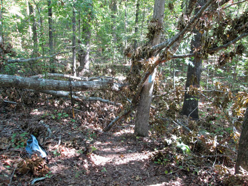
Blowdown North of I20
Saturday, September 24, 2016
Photo by John Calhoun
|
This page discusses the Pinhoti Section between Interstate 20 and the FR500 Railroad Trailhead. The Mother's Day Tornado struck in the south end of this section, and the Shoal Creek Ranger Station is just south of the north end of this Pinhoti Section. It is the north part of Pinhoti Section 8. |

Blowdown North of I20
Saturday, September 24, 2016
Photo by John Calhoun
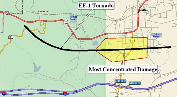 Mother's Day Tornado Map Source: National Weather Service Birmingham | ||||
|
Heflin Tornado - 11 May 2008 The tornado touched down along the Talladega Scenic Drive just south of US Highway 78. The tornado moved along a slightly left curved path until it crossed County Road 79. The tornado then tracked almost due east and produced its most concentrated damage near State Highway 9. The tornado lifted near the end of Brockford Road in the vicinity of Shadow Lane. Hundreds of trees were either snapped off or uprooted along the path. Several structures sustained damage and at least 6 of the structures were destroyed. At least 35 homes suffered varying degrees of damage. No injuries were reported.
Information Above Quoted from: National Weather Service Birmingham The Enhanced Fujita Scale runs from EF0-EF5, with EF0 being the least damaging. This was a fairly moderate tornado where it hit the Pinhoti. It was part of a severe weather system that started in Oklahoma and proceded east. There was a great deal of damage in a swath across Georgia. |
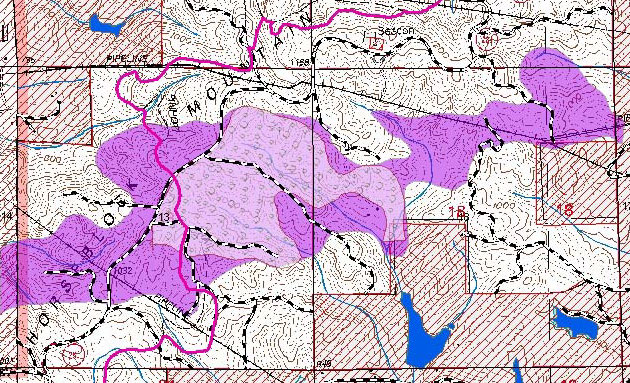 Mother's Day Tornado Damage Map Source: Shoal Creek Ranger District DECISION MEMO |
|
Maps and text from: 165 acres (will be salvage logged) located in Township 16 South, Range 9 East Section 13 and Township 16 South, Range 10 East Section 18. This project will improve visual quality, reduce heavy fuel build up, and facilitate restoration to the desired future conditions as determined by the Revised Land and Resource Management Plan (RLMP).
On May 11, 2008, an EF1 tornado blew down, snapped off and damaged trees within the forest. An estimated 450 acres have areas of concentrated damage. This situation in these areas has created the following concerns: These areas will be treated by removing the damaged trees by commercial timber sale. This action will take place during the months of July and August 2008 |
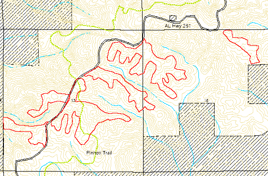 Mother's Day Tornado Salvage Logging Map Source: Shoal Creek Ranger District DECISION MEMO |
|
From Solo's 2008 Turkey Track
14 May 2008 Mother's Day Tornado: Trail Closure Some of you know that this weekends storm did some damage in Heflin. Yesterday we discovered expansive blow downs along Highway 281. The Pinhoti along highway 281 is NOT accessible. The portion of the Pinhoti that we know has the most damage is where the Pinhoti crosses the scenic drive (AL 281), between the two gas pipelines. We are posting this section of trail closed until further notice. Hikers can use highway 281 as an alternate route for this portion of trail. I would like to ask those of you who have web sites or access to web sites to please post this information on your site. We do not know the total extent of the damage to the Forest in that area yet. I will keep you informed on this situation. Thank you all! Lesley
Lesley M. Hodge
12 May 2009 Mothers Day Tornado (08) |
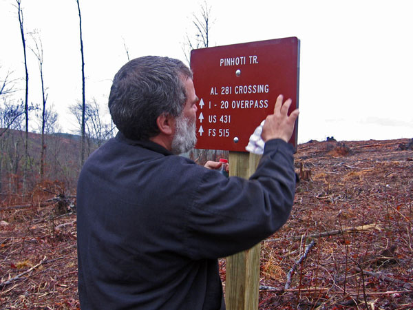 Mother's Day Tornado after Salvage Logging. Photo taken by John Calhoun. °N, °W The author is shown removing incorrect mileages from the new signs; He was part of a large, jovial installation crew. These signs ordered under SO 10379793, PO 7385853 per John Calhoun photo 16 December 2009. |
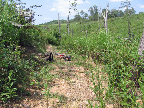 Mother's Day Tornado Brush Clearance. Photo taken by John Calhoun 1 September 2009. °N, °W |
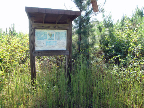
Mothers Day Tornado
Monday, September 26, 2016,
Photo by John Calhoun
|
The mother's day tornado of 2008 ripped down a wide swath of trees over the Pinhoti. It took John many work trips to cut the Pinhoti's path through the tangled trees. Today, it is recovering well, with many blackberries and longleaf pines.
Sun 06/23/13 |
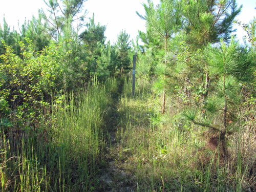
Mother's Day Tornado, Pinhoti Trail, near Alabama 281
Monday, September 26, 2016
Photo by John Calhoun
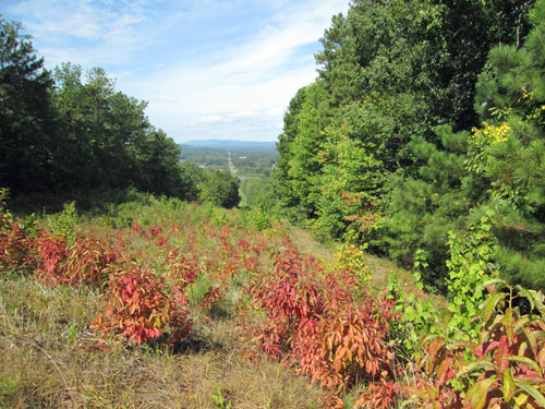
Gas Pipeline View
Sunday, September 11, 2016
Photo by John Calhoun
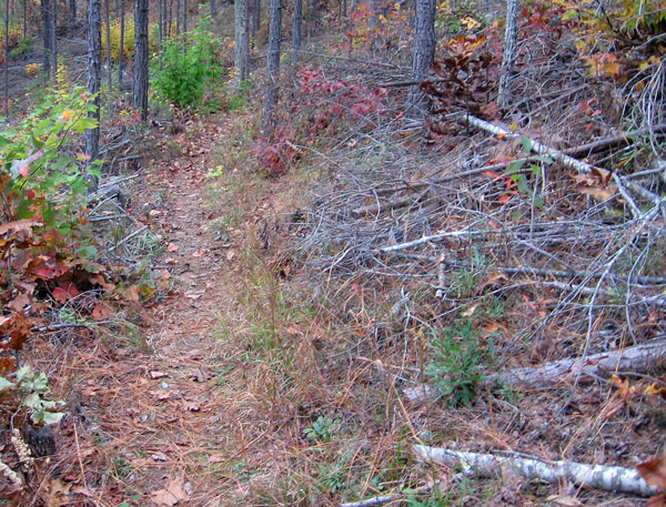 Improper Slash Disposal South of US78 Photo taken by John Calhoun November 9, 2009 |
|
After a company is paid to thin a forest, they are supposed to clear the resulting slash near the trail (~50'), and either cut it so it lays flat and rots away or pile and burn it. Above and below are pictures of cuts trailworkers made through slash left over the Pinhoti Trail. "Where visible, slash will be removed 50 feet from trail’s edge, and slash will be lopped and scattered to lie within 12 inches of the ground in the remainder of the 100 foot zone. Larger slash will be moved downhill from the trail where possible."
Dear Lesley, |
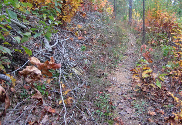 Improper Slash Disposal South of US78 Photo taken by John Calhoun November 9, 2009 |
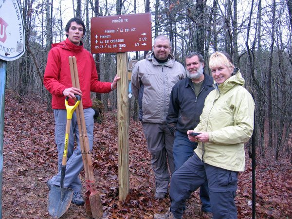 Hunter Samakool, ?, Dan Bedore, O Kenny. Installing signs. Photo taken by John Calhoun. °N, °W |